

01
Context becomes visible
Show the property alongside access, neighborhood character, amenities, land, views and surrounding development.

San Antonio real estate drone services
The service
San Antonio property is shaped by context—from urban infill and historic districts to master-planned communities, commercial corridors and Hill Country acreage. Aerial imagery makes the relationship between architecture, land, access and surrounding character clear at a glance.
Discuss your project
Specialist services
Each service has its own planning questions, deliverables, and quote path. The overview remains available when your assignment crosses more than one category.

Decision-ready property context for offering memoranda, leasing campaigns, investor presentations, websites, and asset portfolios.
Explore this service
Controlled, design-aware aerial imagery for estates, architecture, views, grounds, and high-consideration property marketing.
Explore this service
Aerial assets that connect the property, amenities, arrival, views, neighborhood, and destination experience.
Explore this serviceShow the property alongside access, neighborhood character, amenities, land, views and surrounding development.

Wide, medium, top-down and approach views create flexible material for listings and presentations.

Horizontal and vertical compositions are planned around websites, listings, social and pitch decks.
Visual coverage
Every project is planned around useful viewpoints, clear context, and imagery that supports the final business or creative goal in Greater San Antonio.

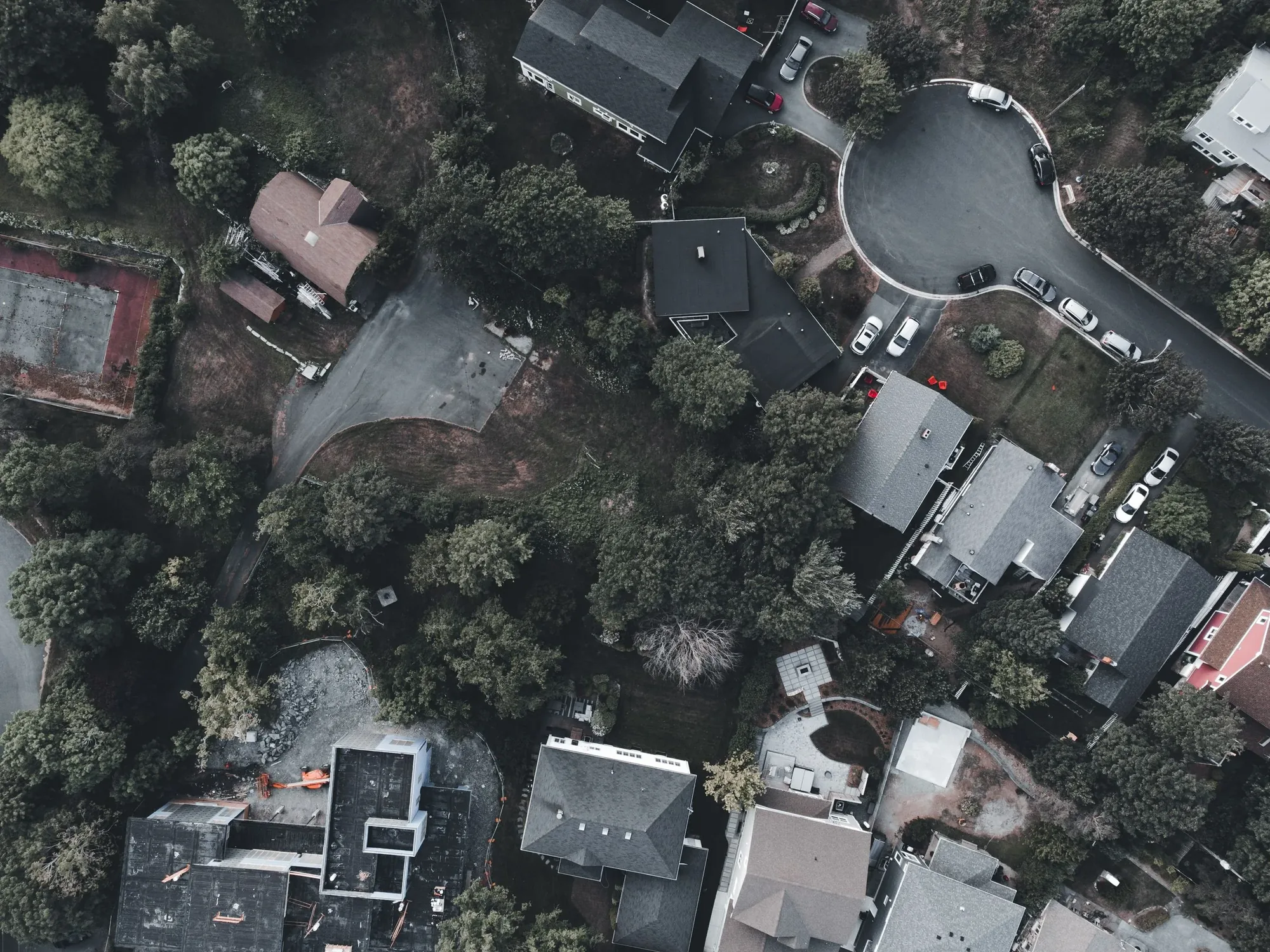
Available deliverables
Aerial photography shows the property, lot, access, nearby features, and surrounding San Antonio context in compositions prepared for listings, presentations, websites, and marketing campaigns.
Aerial video can move from the surrounding Greater San Antonio setting into the property itself, with horizontal and vertical framing planned for listing pages, presentations, social media, and paid campaigns.
Approach and reveal shots build visual context before presenting the property, helping viewers understand arrival, scale, architecture, views, and the relationship to nearby destinations.
Context imagery connects the property to relevant neighborhood, access, landscape, and amenity features across historic districts, residential communities, commercial corridors, and regional development sites, supporting the specific story buyers or stakeholders need to understand.
Organized marketing-ready files is organized for the intended listing, campaign, or presentation, with practical file names, orientations, and delivery formats that make the aerial assets easier to publish and reuse.
Common applications
Residential listings use aerial photography to show lot relationships, access, architecture, views, and neighborhood context across historic districts, residential communities, commercial corridors, and regional development sites, helping buyers understand more than interior photography alone can show.
Commercial real estate imagery can clarify building scale, parking, access, nearby development, visibility, and surrounding commercial context for leasing packages, offering memoranda, presentations, and digital campaigns.
Hospitality and mixed-use properties can use aerial media to connect buildings with amenities, outdoor areas, access, views, and the larger San Antonio destination in one coherent visual story.
Development sites coverage helps stakeholders understand boundaries, access, surrounding uses, construction context, and the relationship between the site and Greater San Antonio. It is visual marketing and documentation, not automatically a survey product.
Broker and investor presentations benefit from organized aerial photography and video that makes scale, access, location context, and development relationships easier to communicate to decision-makers who may not visit in person.
Local planning
Greater San Antonio includes dense downtown property, historic neighborhoods, suburban communities, large commercial sites and Hill Country acreage.
Strong midday light, mature trees and broad parcels can change which altitude and direction best explain a property.
San Antonio International, Stinson, Kelly Field, Randolph and other aviation activity can affect feasibility depending on the exact address.
From brief to delivery
Tell us whether the priority is architecture, lot, access, amenities, views or surrounding context.
We review airspace, access, sun direction, building orientation and practical camera angles.
Capture moves from wide context through closer property views in the requested orientations.
Photography and footage are organized for listings, web, social, decks or an editing team.
Before you book
Yes. Projects can support homes, apartments, office, retail, hospitality, industrial, land and development marketing.
When feasible, composition can show the property’s relationship to streets, districts, parks, commercial centers or skyline. The shot plan should identify which connections matter.
Yes. Vertical and horizontal framing can both be included when identified before capture.
Share the marketing audience, site access, building orientation, entrances, frontage, parking, amenities, nearby context, occupancy constraints, and any claims that must be shown accurately. This turns a generic orbit into a purposeful property story.
Yes, if the required horizontal, vertical, wide, detail, and annotation-ready views are identified before capture. Final crops, editing, file sizes, and usage should be included in the agreed deliverables.
Request a quote
Share the location, timing, deliverables, and how the footage will be used. Those details help us evaluate feasibility and prepare a useful quote.
The View From Above

Technical Documentation · Aug 31, 2026
Map every San Antonio Missions view to its component, owner, heritage claim, capture authority, living use, and allowed derivatives.
Read article
Land Development · Aug 25, 2026
Build a consultant-directed aerial context brief for San Antonio projects over the Edwards Aquifer without mistaking imagery for survey, geology, or approval.
Read article
Construction · Aug 18, 2026
Build a repeatable San Antonio aerial progress record around project-specific views, operating constraints, stakeholder evidence, and disciplined delivery.
Read article
